Flight Distance
Welcome to Flight Distance – your ultimate companion for precise flight planning and estimation! Whether you’re a frequent traveller, seasoned pilot, aviation enthusiast, or simply curious about air travel, this app provides comprehensive tools to calculate distances, travel times, and map routes effortlessly.
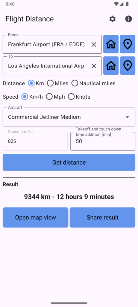
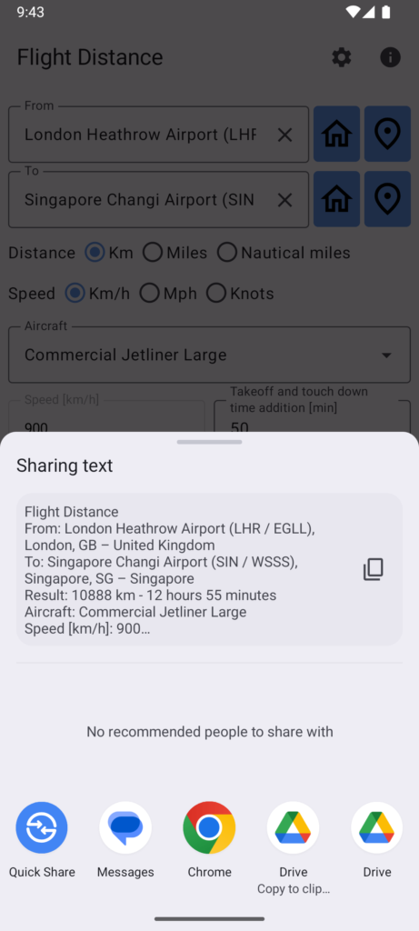
Using Flight Distance is simple: Just enter your departure and destination locations, choose your preferred aircraft category or model, select speed and distance units, and click ‘Get Distance’ for accurate calculations.
Key Features:
- Effortless Calculation: Quickly calculate flight distance and estimated travel time between any two locations worldwide, be it airports, cities, and more.
- Powerful Airport Database: The integrated database includes airports, airfields and heliports from around the globe and supports search by codes, names and locations.
- Aircraft Selection: Choose from a comprehensive database of aircraft categories and models, or input custom parameters for personalized results.
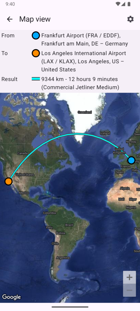
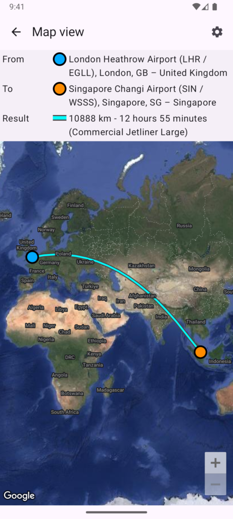
- Map Integration: Visualize your route on a map with options for great-circle navigation or direct line type.
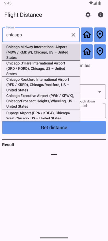
- Easy Input: Seamlessly integrate with location autocomplete for easy input, ensuring accuracy and efficiency in entering departure and destination points.
- Customization Options: Customize the GUI and settings to suit your preferences, including setting home and current locations for quick retrieval.
Flight Distance caters to aviation enthusiasts, pilots, travelers, and anyone interested in air travel. Whether you’re planning a cross-country flight, estimating travel times for a commercial airline journey, or simply exploring the world of aviation, this app empowers you with the tools you need for informed decision-making and seamless navigation.
Download Flight Distance now and embark on your journey with confidence! Explore the skies, calculate your flight plans, and experience the thrill of aviation right from your fingertips!
Manual
- Inputting Locations: Enter the departure (“from”) and destination (“to”) locations in the designated fields. Flight Distance will provide autocomplete suggestions based on your input.
- Selecting Speed and Units: Choose the desired speed unit (km/h, mph, knots) and distance unit (km, miles, nautical miles).
- Choosing Aircraft: Select an aircraft category or specific model from the predefined list. Alternatively, choose ‘Custom’ to input your own cruising speed and time additions.
- Calculating Distance: Click on the ‘Get Distance’ button to calculate the distance and estimated travel time.
- Viewing Results: The app will display the calculated distance and travel time. You can also view the route on a map.
FAQ
Q: How accurate are the distance and travel time calculations?
A: Flight Distance utilizes advanced algorithms to calculate distances and travel times accurately. However, actual flight durations may vary due to factors such as aircraft, weather conditions and air traffic.
Q: How does the “Takeoff and touch down time addition” work in Flight Distance?
A: The “Takeoff and touch down time addition” feature accounts for the additional time required during the takeoff and landing phases of a flight. These phases involve various procedures such as taxiing, ascent, descent, and runway clearance, which are not accounted for in the cruising speed. Flight Distance includes a predefined time addition for these phases based on the selected aircraft category or model. Users can adjust this time addition as per their preference or specific aircraft requirements.
Q: Can I calculate distances between non-airport locations?
A: Yes, Flight Distance allows you to calculate distances between any two locations, whether they are airports, cities, landmarks, or addresses.
Q: Can I save custom aircraft in Flight Distance?
A: Currently, Flight Distance does not support the saving of custom aircraft configurations. However, this feature may be implemented in a future update.
Q: What is the significance of the line type shown on the map in Flight Distance?
A: In Flight Distance, the line type refers to the method used to connect the departure and destination points on the map. Users can choose between three options: “Great-circle navigation”, “Direct” and “Both”.
- Great-circle navigation: This option draws a line representing the shortest distance between two points on the surface of a sphere, such as the Earth. It follows the path of a great circle, which is the shortest path between two points on a sphere. This option provides a more accurate representation of flight paths, especially for long distances, as it takes into account the Earth’s curvature.
- Direct Line: This option draws a straight line between the departure and destination points on the map, representing the shortest path between the two locations on a flat surface. While visually straightforward, it may not accurately reflect the actual flight path, especially for long distances, as it does not consider the curvature of the Earth.
- Both: Draw both of the options above.
Q: How do the autocomplete airports / location proposals work?
A: Flight Distance offers dynamic autocomplete suggestions based on user input. This feature allows for easy selection of airports and locations, ensuring convenience and accuracy in distance calculations. Suggestions appear once the user has finished typing, encompassing a wide range of airports, airfields & heliports, locations, along with street names or cities. Partial input (even incomplete words) is also supported.
The app uses a built-in worldwide database of airports, airfields and heliports. Search terms are matched against:
- Airport identifiers (IATA, ICAO, GPS or local codes)
- Airport / airfield / heliport names
- City and country names
If a specific location is not found, users may try rewording it slightly to refine their search.
Q: Is internet connection required?
A: Yes, an internet connection is needed for the app to work.
Q: Can I suggest new features or report issues?
A: Absolutely! We welcome feedback from our users. You can send us your suggestions or report any issues, thx!
Download
Get the app for free on the Android Play Store:

https://play.google.com/store/apps/details?id=io.specsoft.flightdistance
Attribution & Licenses
This app may uses following services:
Google Maps SDK for Android
Airports data from:
https://ourairports.com
This app may uses resources (images, fonts, etc.) that were published under following licences:
MIT License
SIL Open Font License